|
Metropolitan Area
Dallas Austin San Antonio |
Exposure Risk
Low Low Moderate |
Date Issued: 8 January, 2014
Mountain Cedar location(s): Edwards Plateau, Texas.
Regional weather: Thursday, January 8 – TX/OK: Across the region today conditions will be cold with the warmest areas in the mid-40s across central Texas and the mid-30s in southern Oklahoma. Skies across Texas will be mostly cloudy but thinning to the north with the Dallas/Fort Worth area expecting sunny skies. Temperatures in most areas dipped well below freezing overnight and will take some time to warm. Winds will be from the southwest across the Edwards Plateau and from the south in north Texas and southern Oklahoma. Wind strength will be strong to the north and moderate to light across the rest of the region. The edge communities will begin the day with northeasterly winds but they too will shift this afternoon coming from the south. High temperatures across the entire region are only expected to get into the low 40 degree range. In Oklahoma, the high temperatures will not get out of the 30 degree range. Tonight a chance of precipitation comes into the forecast. The area will remain with cloudy and mostly cloudy conditions. In the edge communities and to the far west there will be a 20% chance of rain, frozen rain, or sleet. Temperatures in the edge communities will stay in the mid- to low 30s. Winds tonight will start from the south but will be overtaken by another push of very cold air from the north for tomorrow. Skies across the region will remain cloudy to mostly cloudy and winds will be from the north to northeast across the region. Tomorrow the high temperatures in Texas are not expected to get above the low 40s in the warmest areas. The Plateau north to Dallas will be in the 30s the entire day and southern Oklahoma should stay below freezing. Across Texas there will be a chance of precipitation with the edge communities showing a 40% chance of rain and/or freezing rain. Winds will be moderate from the north to northeast. Tomorrow night similar conditions will continue, however the chance of freezing rain, sleet will increase with most temperatures expected to bottom out in the twenties across the central and southern areas of the Plateau and out into the edge communities along the I-35 corridor.
Trajectory weather: Air mass trajectories over Texas today will move to the north on light winds then tonight begin to reverse as cold air from the north moves over the region for tomorrow and tomorrow night. Temperatures across the region today will top out in the mid-40 degree range in the warmest locations. Skies will be mostly cloudy today and tonight a chance of precipitation begins to build that will last into tomorrow and tomorrow night. With the cold conditions there is a chance than any precipitation may fall as freezing rain and/or sleet. Tomorrow conditions will worsen as most high temperatures will struggle to get beyond the 30 degree range. The chance of precipitation, in the form of freezing rain and sleet, will expand across central Texas. Winds will remain light to moderate from the north and northeast. Tomorrow night cloudy conditions and the continuing chance of precipitation will occur. Low temperatures will mostly fall in the mid- to upper 20s, and the San Antonio metro area along with the southernmost region along the I-35 corridor will be in the low 30s. Overall poor conditions for pollination as the trees will not see conditions outside of the low 40s over the forecast period. In addition any pollination will be entrained in dense air moving along the ground surface that usually causes impaction and deposition out of the air stream.
OUTLOOK: ***Low Threat today and Low Threat Tomorrow. The tree populations continue to be exposed to prolonged cold conditions. The exception is the surrounding edge communities where temperatures have been a bit warmer. However, today conditions will be cold and getting colder over the forecast period. Central Texas is not expected to warm above the low 40s today or tomorrow. In addition, there will be an increasing chance of precipitation that will fall as frozen or partially frozen rain and sleet. Winds will be light to moderate moving towards the northeast today then reverse overnight and move southward as another push of cold air comes into the region for tomorrow. High temperatures tomorrow will stay mostly in the 30s with only the communities that are furthest south getting into the low 40 degree range. Overall conditions will be poor for pollen release, entrainment and travel today, tonight, and tomorrow along with tomorrow night. For these reasons the forecast is LOW for the next two day period.
Trajectory
Start (s) (shown by black stars on map):
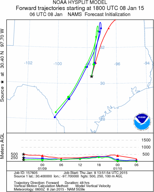
Austin, TX
Austin, TX
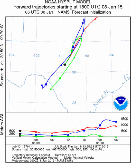
Junction, TX
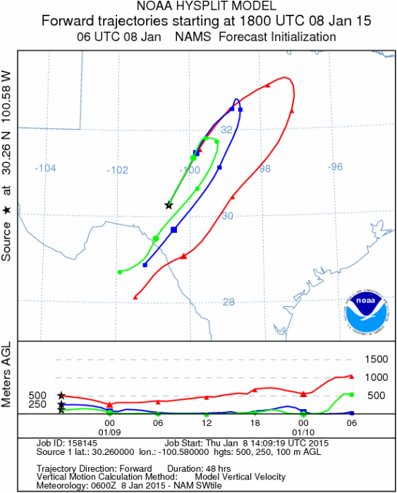
Sonora, TX
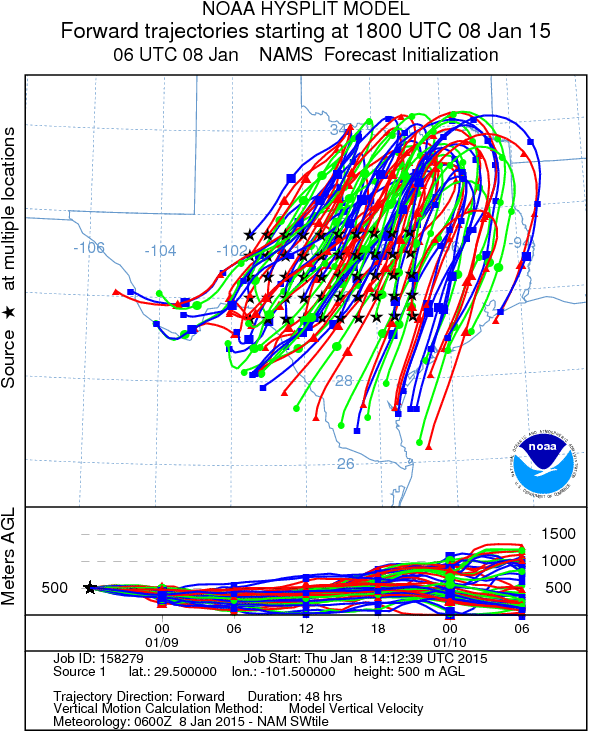
Matrix of sites across the Edwards Plateau (100 meters; 12:00 pm cst)
Prepared by: Estelle Levetin (Faculty of Biological Science, The University of Tulsa, 800 S. Tucker Dr., Tulsa, OK 74104) and Peter K Van de Water (Department of Earth and Environmental Science, California State University Fresno, 2576 East San Ramon Avenue, M/S ST24, Fresno CA 93740-8039). This forecast gives the anticipated future track of released Mountain Cedar pollen, weather conditions over the region and along the forecast pathway, and an estimated time of arrival for various metropolitan areas.Questions: Aerobiology Lab e-mail: [email protected]
Return to ForecastingHome Page
Return to ForecastingHome Page
