|
Metropolitan Area
Dallas Austin San Antonio |
Exposure Risk
Low Moderate Moderate |
Date Issued: December 27, 2014
Mountain Cedar location(s): Edwards Plateau, Texas.
Regional weather: Saturday - Sunday, December 27 and 28 – TX/OK: Across the region today skies will cloudy to mostly cloudy with the day beginning with the chance of rain. To the north in central and southern Oklahoma there will be a 20% chance, increasing to 30% in north Texas. The chance of rain increases to 40 and 50% in the edge communities along the I-35 corridor. The cloudy conditions and rainfall occurs as the winds have switched from yesterday coming from the north, heading due south. Along with the chance of moisture throughout the region temperatures will be cool, with the Plateau and areas northward, except the edge communities, staying in the 40s today. The edge communities will climb to the mid- to upper 50s. With the shift to a northerly flow, winds will be in the moderate range with gusts reaching into the 25 to 30 mile per hour range. Overall a breezy, chilly day is on tap for the region. Overnight mostly cloudy skies will prevail with temperatures dropping into the upper low 30’s and upper 20s across the Edwards Plateau, and into the 30’s in the edge communities. Temperatures are expected to be in the mid-20s across southern Oklahoma. Winds will remain from the north at moderate levels, dropping off a bit towards the morning. Tomorrow, mostly sunny to clear and sunny skies will begin to build in. Temperatures across Texas will begin to rebound with most areas across the Edwards Plateau reaching the mid to upper 50s. Winds will be light, 5 to 10 miles per hour. In northern Texas moving into southern Oklahoma temperatures will remain in the 40s, but under mostly sunny skies with light and variable winds. Tomorrow night winds will begin to shift coming from the south at generally light conditions. Temperatures will drop into the 30’s, but be not as cold as tonight.
Trajectory weather: Air mass trajectories over the Edwards Plateau today will be influenced by moderate to strong flow from the north and cold conditions. Temperatures across the Plateau region will be in the 40s with only the areas surrounding the eastern Plateau edge getting into the low 50’s. Areas from Junction to southern Oklahoma will have a chance of precipitation today as systems move through. The area will see scattered showers as well as the potential development of thunderstorms. Winds will be in the moderate range but most areas may see gusts as high as 30 mph. Tonight, temperatures will drop into the low 30s and upper 20s across the Plateau and the mid-30s in the edge communities. The skies will continue to be cloudy but the chance of rainfall decreases. Winds will remain from the north at moderate conditions. A slight chance of rain will remain in the edge communities. Tomorrow skies will begin to clear and temperatures are expected to rebound back into the 50s. Winds will drop to mostly light conditions and continue from the north, except to the far southwest where a more westerly breeze will begin. Tomorrow nighttime low temperatuers will be warmer and a southwesterly flow will move over the region. Winds will remain light and skies will be mostly clear.
OUTLOOK: ****** Moderate Threat today and High to SEVERE Threat Tomorrow *** poor conditions for pollen release today with cold temperatures in the 40s on the Plateau and in north Texas, but 50’s in the edge communities where it will be very windy. Winds will be from the north with strong gusts of 25 to 30 miles per hour. Conditions for release will be poor with temperatures in most places remaining in the 40s, however in the surrounding communities warmer conditions will allow some pollen to become airborne. Once airborne it will be entrained and may travel long distances because of the strong winds from the north. Tomorrow skies will begin to clear and temperature across southern and central Texas allowing pollen to be released as well as entrained and move downwind. The air mass on both days will be cold and travel near the ground. Therefore the forecast for tomorrow is for a high threat and will probably be sever in the surrounding communities.
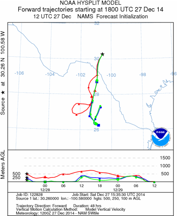
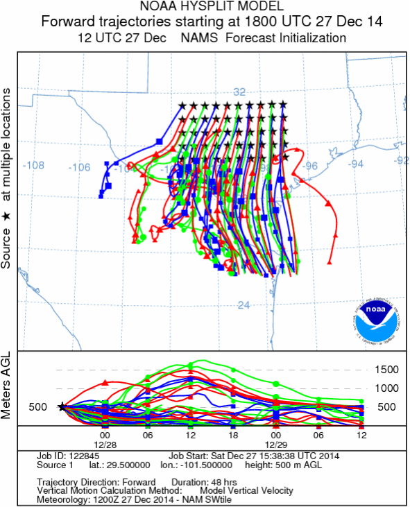
Trajectory Start (s) (shown by black stars on map):
Austin, TX
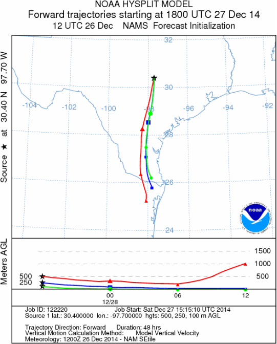
Junction, TX
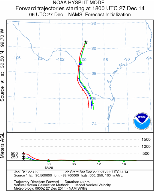
Sonora, TX
Matrix of sites across the Edwards Plateau (100 meters; 12:00 pm cst)
Prepared by: Estelle Levetin (Faculty of Biological Science, The University of Tulsa, 800 S. Tucker Dr., Tulsa, OK 74104) and Peter K Van de Water (Department of Earth and Environmental Science, California State University Fresno, 2576 East San Ramon Avenue, M/S ST24, Fresno CA 93740-8039). This forecast gives the anticipated future track of released Mountain Cedar pollen, weather conditions over the region and along the forecast pathway, and an estimated time of arrival for various metropolitan areas.Questions: Aerobiology Lab e-mail: [email protected]
Return to ForecastingHome Page
Return to ForecastingHome Page
