|
Metropolitan Area
Dallas Austin San Antonio |
Exposure Risk
Low Mod Mod |
Date Issued: 19 December 2014
Mountain Cedar location(s): Edwards Plateau, Texas.
Regional weather: Friday, December 19 – TX/OK: Across the region today skies will be cloudy with a moderate flow from the north to northeast across the region. To the north in Oklahoma winds will be light and variable.. On the Plateau itself winds will be from the north to northeast. Temperatures across Texas today will grade from the mid-40s to the north, 50s across the Edwards Plateau and into the 60s at the southern edge communities. There will be a chance of showers across the entire region. In Oklahoma there will be a 20% to 30% chance of rain with drizzle and foggy conditions. In north Texas the chance of rain increases to 60% in the Dallas/Ft Worth area. Southward along the I-35 corridor the chance of rain will climb to 70%. The Edwards Plateau will have a 40% chance to the west, rising towards the east. By this evening the chance of showers will have moved off to the east with skies becoming partly cloudy in most areas. Winds will remain light overnight and from the north to northeast. Saturday, skies will become partly cloudy with clearing to the far west. Temperatures will be in the 50s region wide and winds will be light from the southeast in most areas. Northeasterly winds will remain in the edge communities along the I-35 corridor. Saturday night partly to mostly cloudy skies will occur and temperatures will drop into the 30s over the Plateau and in southern Oklahoma, and be in the mid to low 40s in the edge communities from Waco to Austin and west to San Antonio.
Trajectory weather: Air mass trajectories over Texas will again remain relatively stable not moving much as winds circle over the area. Temperatures will be cool with most areas in the 50s. San Antonio may reach 60 today. Last night a front dropped southward across the region bringing with it a significant chance of rain, especially along the eastern edge of the Edwards Plateau. Winds will be from the north to northeast at 5 to 10 miles per hour. Friday afternoon and evening conditions will begin to improve as the system moves towards the east. There will be a chance of pollen being dispersed prior to the initiation of showers, the past few days have shown that the trees have ripe cones and pollen is being entrained into the atmosphere. However, any rain showers will wash any entrained pollen from the atmosphere. Overall today will have a potential for pollen in the atmosphere early but then should clear as rain develops.
OUTLOOK: *** Moderate Threat early today prior to forecast rain showers and Moderate to high Threat Tomorrow *** good conditions for pollen release early today, degrading to poor conditions in the afternoon to tomorrow morning. Yesterday’s pollen levels show that the trees are already pollinating and areas of heavy pollen concentrations were recorded, depending upon the timing of the developing rain showers today pollen may become entrained in the atmosphere. Tomorrow conditions will begin to improve with temperatures in the mid 50s and partly cloudy skies. As the trees dry out pollen conditions for release is expected to improve, especially in the warmer southern areas. For that reason we are expecting moderate to high conditions on Saturday.
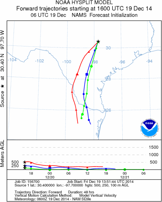
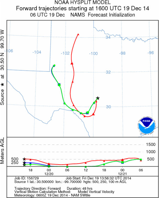
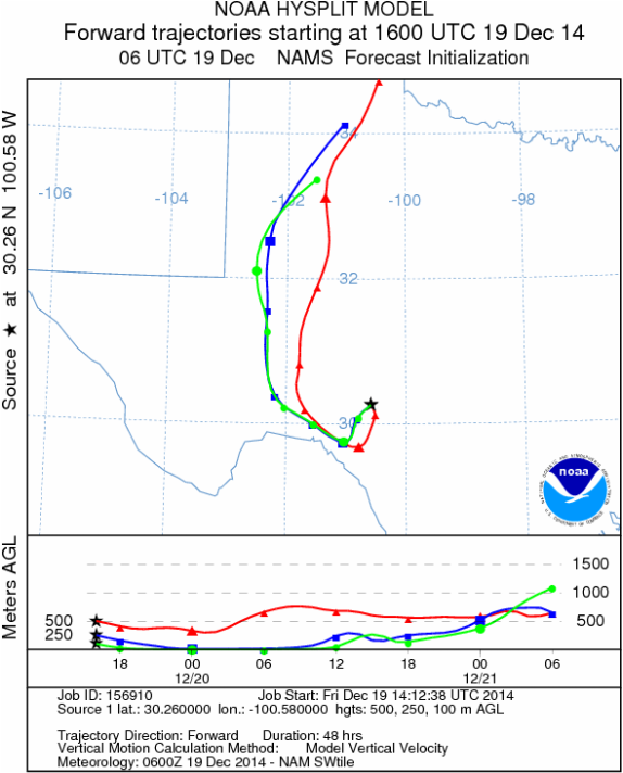
Trajectory Start (s) (shown by black stars on map):
Austin, TX
Junction, TX
Sonora, TX
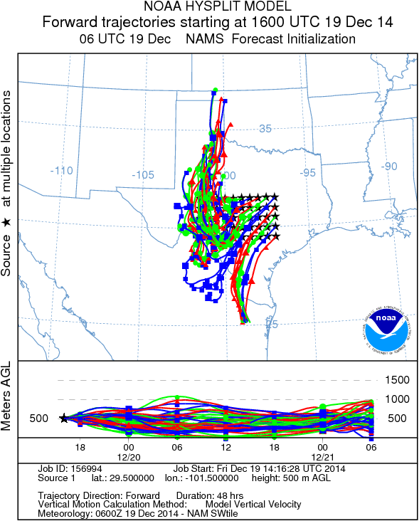
Matrix of sites across the Edwards Plateau (100 meters; 12:00 pm cst)
Prepared by: Estelle Levetin (Faculty of Biological Science, The University of Tulsa, 800 S. Tucker Dr., Tulsa, OK 74104) and Peter K Van de Water (Department of Earth and Environmental Science, California State University Fresno, 2576 East San Ramon Avenue, M/S ST24, Fresno CA 93740-8039). This forecast gives the anticipated future track of released Mountain Cedar pollen, weather conditions over the region and along the forecast pathway, and an estimated time of arrival for various metropolitan areas.Questions: Aerobiology Lab e-mail: [email protected]
Return to ForecastingHome Page
Return to ForecastingHome Page
